Progress & Results
We are measuring recovery, not just activity.
Restoration is not a numbers exercise.
We track acres treated, fencing installed, plants established, erosion-control structures built and other measurable work because those numbers tell us the scale and intensity of our effort.
But the work itself is not the outcome.
KCWA is looking for science-backed signs that ecological processes are beginning to recover.
Guided by our technical advisors, restoration practitioners, GIS specialists, agency partners and established watershed science, we are building a monitoring program that asks deeper questions:
Is soil becoming more protected and staying in place?
Is erosion slowing?
Are native plants surviving, growing and regenerating?
Are invasive species becoming less dominant?
We combine quantitative monitoring with kilo — careful, repeated observation of place over time — to understand how the watershed responds to restoration, weather, disturbance and changing seasons.
We will not claim an ecological result simply because an action was completed.
We want to know whether the land itself is changing.
The numbers below represent work completed across KCWA’s connected restoration landscape. They tell us where and how much we have intervened. In the sections that follow, we connect that work to the ecological changes we are working toward — and the signs of renewal we are monitoring over time.
PROGRESS AT A GLANCE
Restoration taking shape across the landscape
64+ ACRES
Under invasive-species management
GIS-documented treatment of black wattle and other priority invasive vegetation, with follow-up control and maintenance continuing.
What this creates: More space and resources for desired vegetation to establish — and an opportunity to shift the landscape away from repeated invasive dominance.
~120 ACRES
One connected restoration landscape
Restoration and long-term stewardship coordinated across the Kula Fire burn area.
Why scale matters: Water, wildfire, erosion, invasive plants and wildlife do not stop at property lines.
~80 ACRES
Protected from ungulate pressure
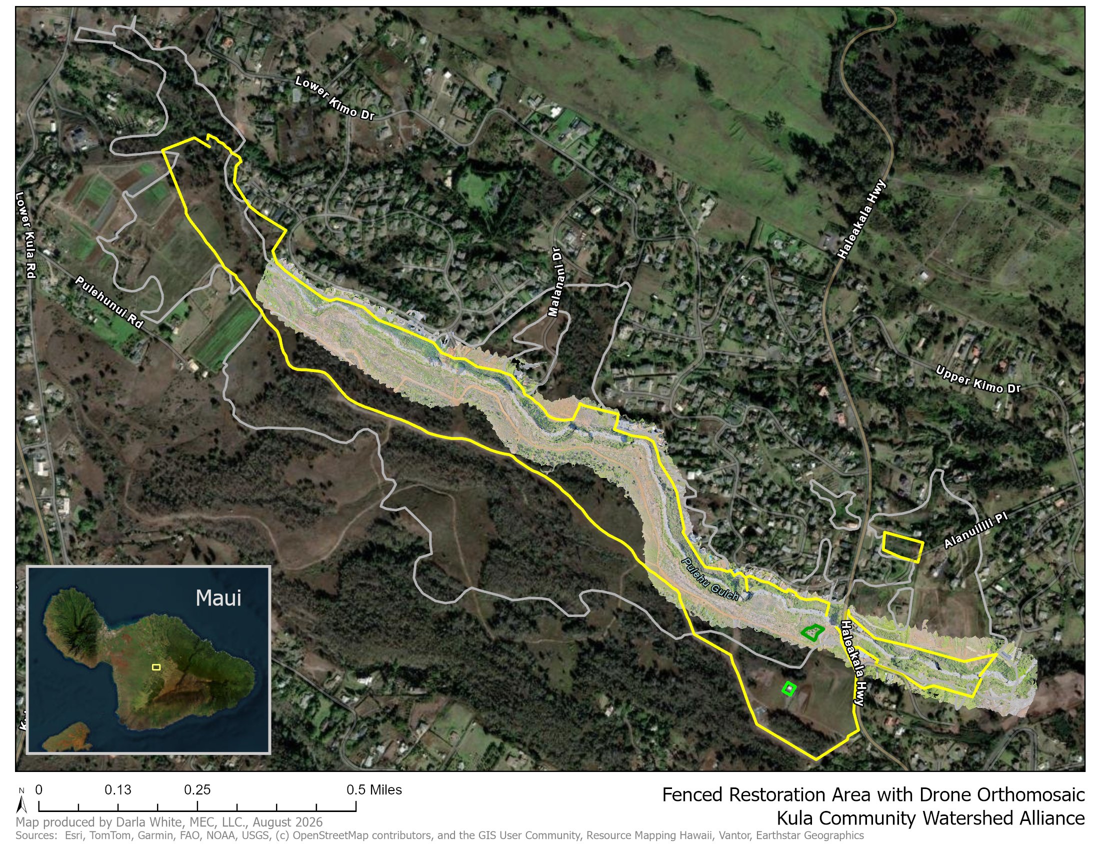
Large-scale deer-exclusion fencing is creating protected restoration areas across some of the most severely burned portions of the landscape.
What this creates: Room for ecological processes to recover without constant browsing and hoof disturbance.
84 PROPERTIES
Working across property lines
Fire-affected landowners participating in a coordinated, landscape-scale approach to recovery.
Why connection matters: Ecological recovery becomes more achievable when neighboring lands are planned and cared for together.
2.3+ MILES
Of conservation fencing completed
Large connected restoration areas are being enclosed and protected from ungulate pressure.
What this creates: Better conditions for young plants to survive, soils to remain less disturbed, and vegetation to regenerate.
These are measures of effort — not the finish line.
Acres treated, fences built and properties engaged tell us what we have done.
The more important question is:
What is changing on the land?
That is what we are beginning to measure next.
What Renewal Looks Like
The work is visible. The deeper question is what is changing on the land.
Each restoration action is intended to influence ecological processes over time. Explore the sections below to see what we’re working toward, what we’re doing, the progress we track, and the signs of renewal we monitor.
Soil • Water • Vegetation • Invasives • Ungulates • Self-renewal
-
More protective ground cover. Less erosion and sediment moving downslope.
WHAT WE’RE WORKING TOWARD
A landscape where soil remains in place during heavy rain, exposed ground becomes increasingly protected, and less sediment is carried into gulches and downstream waters.WHAT WE’RE DOING
We stabilize vulnerable slopes with mulch, erosion-control wattles, woody material, biochar, vegetation and other site-appropriate treatments. Whenever possible, woody biomass removed during hazard reduction is reused on the land rather than exported from the watershed.PROGRESS WE TRACK
Areas stabilized, erosion-control structures installed and maintained, mulch applied, planting sites prepared, and vegetation established on previously exposed ground.SIGNS OF RENEWAL WE MONITOR
Ground cover • exposed soil • visible erosion • sediment movement • performance of erosion-control structures • vegetation establishment • how treated areas respond during and after major rain events -
More opportunity for rainfall to enter the soil instead of rapidly leaving the landscape.
WHAT WE’RE WORKING TOWARD
Improved watershed function: soils that can receive and retain more moisture, vegetation that helps slow the movement of water, and less rapid runoff from fire-damaged slopes.WHAT WE’RE DOING
We rebuild vegetative cover, protect soils with organic material, establish native trees, shrubs and groundcovers, stabilize slopes, and reduce disturbances that leave soil bare or compacted.Our DWS-funded monitoring will allow us to look more directly at how restoration influences soil moisture and infiltration over time.
PROGRESS WE TRACK
Acres treated and restored, vegetation established, soil-protection treatments completed, and hydrologic monitoring infrastructure installed.SIGNS OF RENEWAL WE MONITOR
Soil moisture • infiltration • ground cover • vegetation density • runoff patterns • erosion after storms • changes in how long moisture remains in treated areas -
Less reinvasion. More room for resilient vegetation to establish.
WHAT WE’RE WORKING TOWARD
A landscape where black wattle and other priority invasive species become less dominant and native and other appropriate vegetation increasingly occupies the available space.WHAT WE’RE DOING
Invasive management includes mechanical removal, hand removal, targeted treatment where appropriate, follow-up weed control, mulching and repeated maintenance. We then establish desired vegetation rather than leaving treated ground open for the same invasive species to return.PROGRESS WE TRACK
More than 64 acres have been documented through GIS as receiving invasive-species management, with follow-up treatment and maintenance continuing.SIGNS OF RENEWAL WE MONITOR
Invasive regrowth • seedling recruitment • invasive cover and density • native plant survival • desired ground cover • developing shade • frequency and intensity of retreatment requiredThe long-term goal is not simply to keep removing weeds. It is to help create conditions in which the landscape becomes increasingly resistant to reinvasion.
-
Native vegetation surviving, growing, filling ecological roles — and eventually regenerating on its own.
WHAT WE’RE WORKING TOWARD
A more diverse and structurally complex plant community, with trees, shrubs, ferns, grasses and groundcovers contributing roots, shade, litter, habitat and soil protection.WHAT WE’RE DOING
KCWA propagates and installs native species selected for the different elevations, moisture conditions and restoration needs found across the burn scar. Planting is followed by watering, weed control, pest management, monitoring and establishment care.PROGRESS WE TRACK
Plants propagated and installed, species represented, properties and restoration units planted, acres under establishment care, and maintenance visits completed.SIGNS OF RENEWAL WE MONITOR
Plant survival • growth and vigor • canopy and groundcover development • species diversity • natural recruitment • flowering and seed production • shade development • establishment without supplemental careWe do not measure success by the day a plant goes into the ground. We measure success by whether it becomes part of the recovering landscape.
-
Less browsing and disturbance. More opportunity for vegetation to establish.
WHAT WE’RE WORKING TOWARD
Large connected restoration areas where young plants, recovering soils and naturally regenerating vegetation are not continually disrupted by axis deer and other ungulates.WHAT WE’RE DOING
KCWA is constructing and maintaining conservation fencing, creating large multi-property exclosures, monitoring for breaches and ungulate activity, and coordinating removal and management where necessary.PROGRESS WE TRACK
More than 2.3 miles of conservation fencing had been completed by July 2026, with additional fencing continuing. Large-scale fencing is creating protected restoration areas across approximately 80 acres of severely fire-affected land.SIGNS OF RENEWAL WE MONITOR
Ungulate presence • fence integrity • browsing evidence • hoof disturbance • seedling survival • natural recruitment • vegetation response inside protected areasOver time, the ecological result we care about is not the fence itself. It is what begins to grow because the fence is there.
-
Over time, healthy ecological processes should begin carrying more of the work.
WHAT WE’RE WORKING TOWARD
A landscape that becomes increasingly capable of maintaining soil cover, supporting vegetation, cycling organic material, retaining moisture and recovering from disturbance without constant intensive intervention.WHAT WE’RE DOING
KCWA combines stabilization, invasive-species management, fencing, native planting, establishment care, monitoring and long-term maintenance rather than treating restoration as a one-time project.Our crews return repeatedly to the same places — observing, weeding, watering, repairing, planting, monitoring and adapting treatment as the landscape changes. That repeated stewardship is a central part of ecological restoration.
PROGRESS WE TRACK
Treatment frequency, maintenance effort, repeat visits, establishment care and the transition of sites from intensive intervention toward longer-term stewardship.SIGNS OF RENEWAL WE MONITOR
Natural regeneration • increasing vegetative cover • declining invasive recruitment • reduced maintenance needs • developing canopy and shade • stable soils • plant reproduction • recovery following weather and disturbanceUltimately, one of the strongest signs of success may be that the land begins to need less from us.
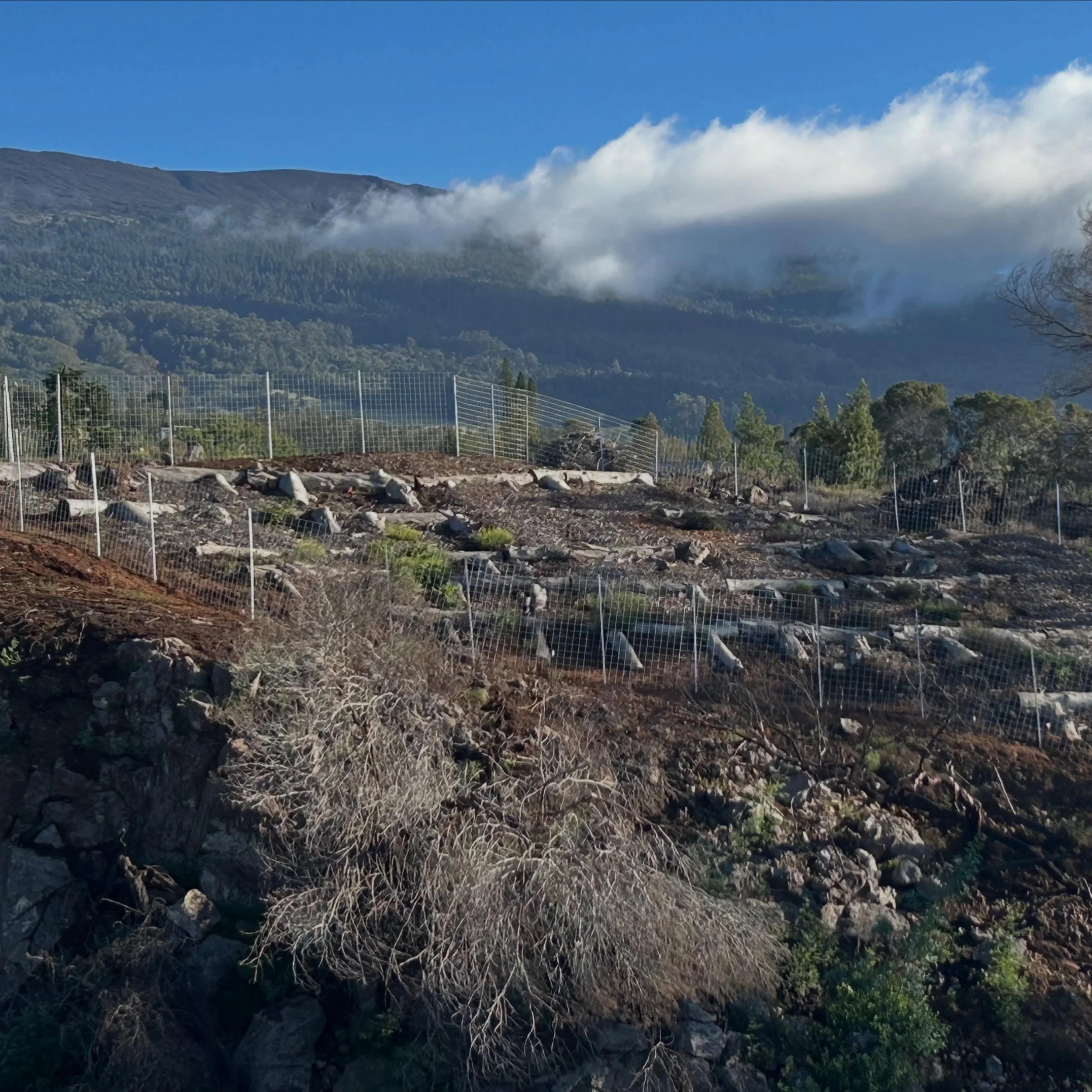
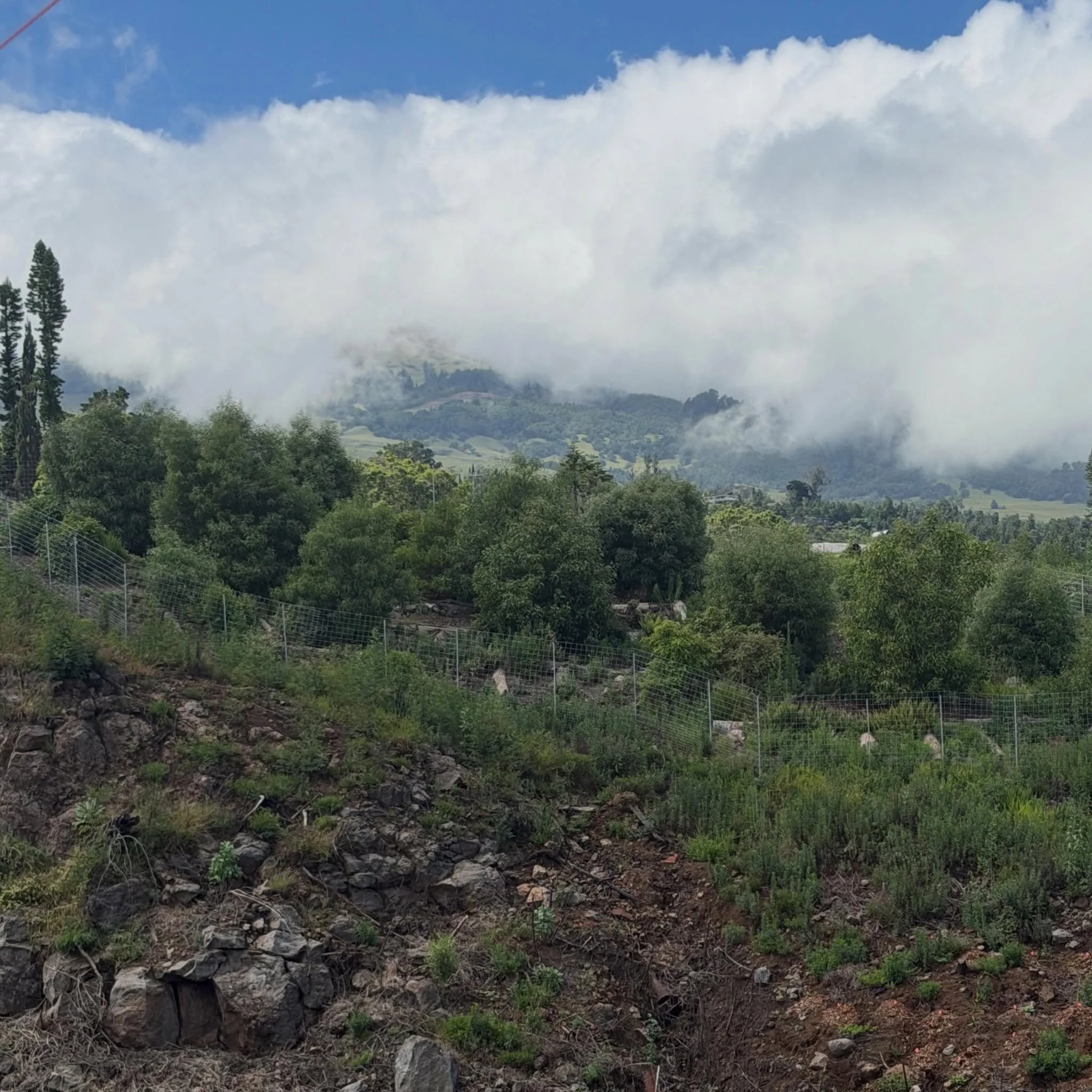
KCWA Restoration Area, November 2024
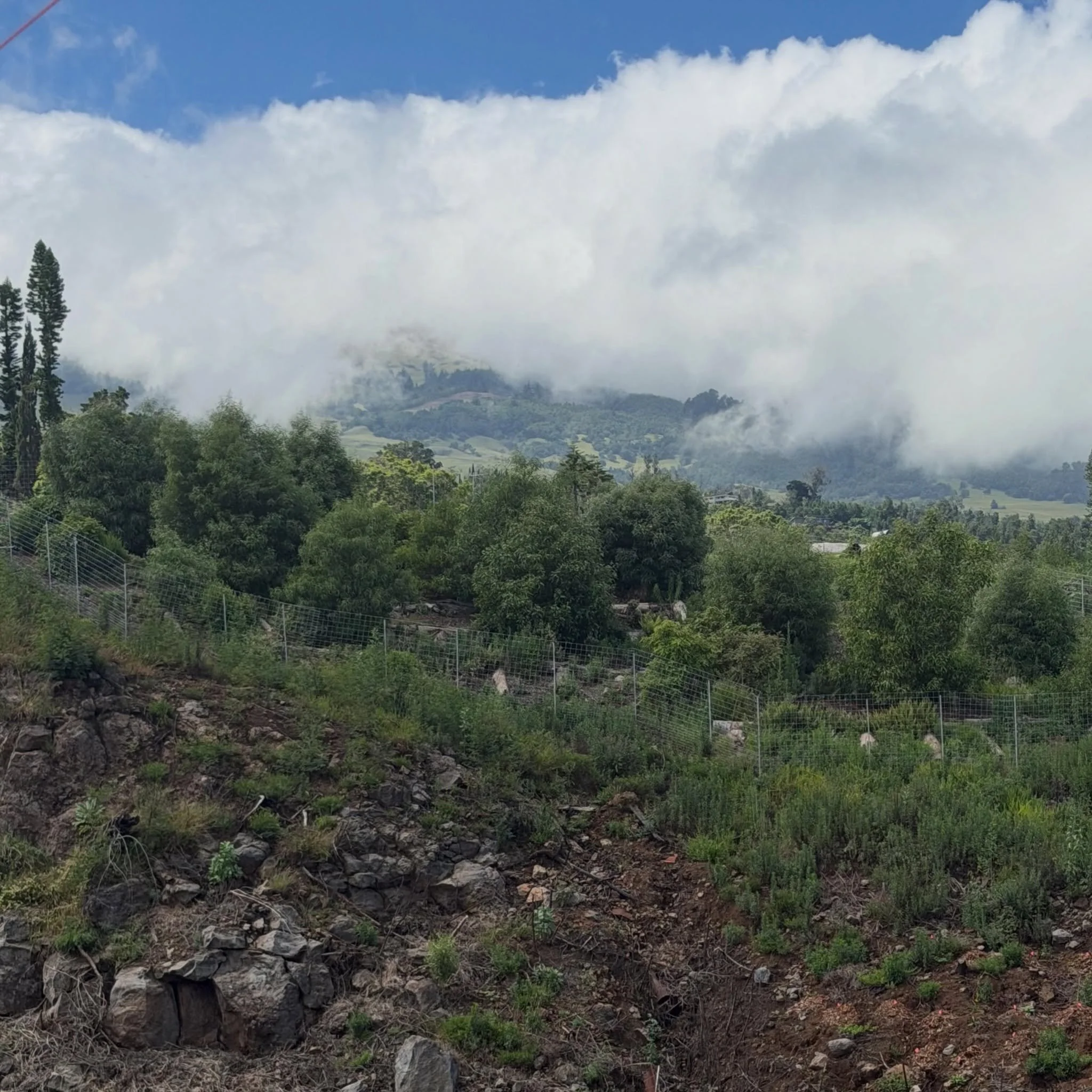
KCWA Restoration Area, November 2026
How we know the landscape is changing
We combine quantitative monitoring with kilo — careful, repeated observation of place over time — to understand how restoration sites respond to treatment, weather, disturbance and changing seasons.
Our monitoring approach is guided by KCWA’s scientific and technical advisors, restoration practitioners, GIS specialists and agency partners, and informed by established watershed and restoration science.
Depending on the site and the question we are asking, that can include repeat photography, GIS and drone imagery, vegetation monitoring, erosion indicators, soil-moisture and infiltration measurements, ungulate observations, field inspections and long-term maintenance records.
The goal is not simply to document what we did. It is to understand whether the land is moving in the direction we intended.
Follow the Restoration
Restoration unfolds over time. Explore the field reports, maps and monitoring that document how the landscape is changing season by season.
Quarterly Field Reports
See what changed this season.

Photos, field updates, completed work, maintenance and what’s coming next across participating properties.
Living StoryMap
See the restoration across the landscape.
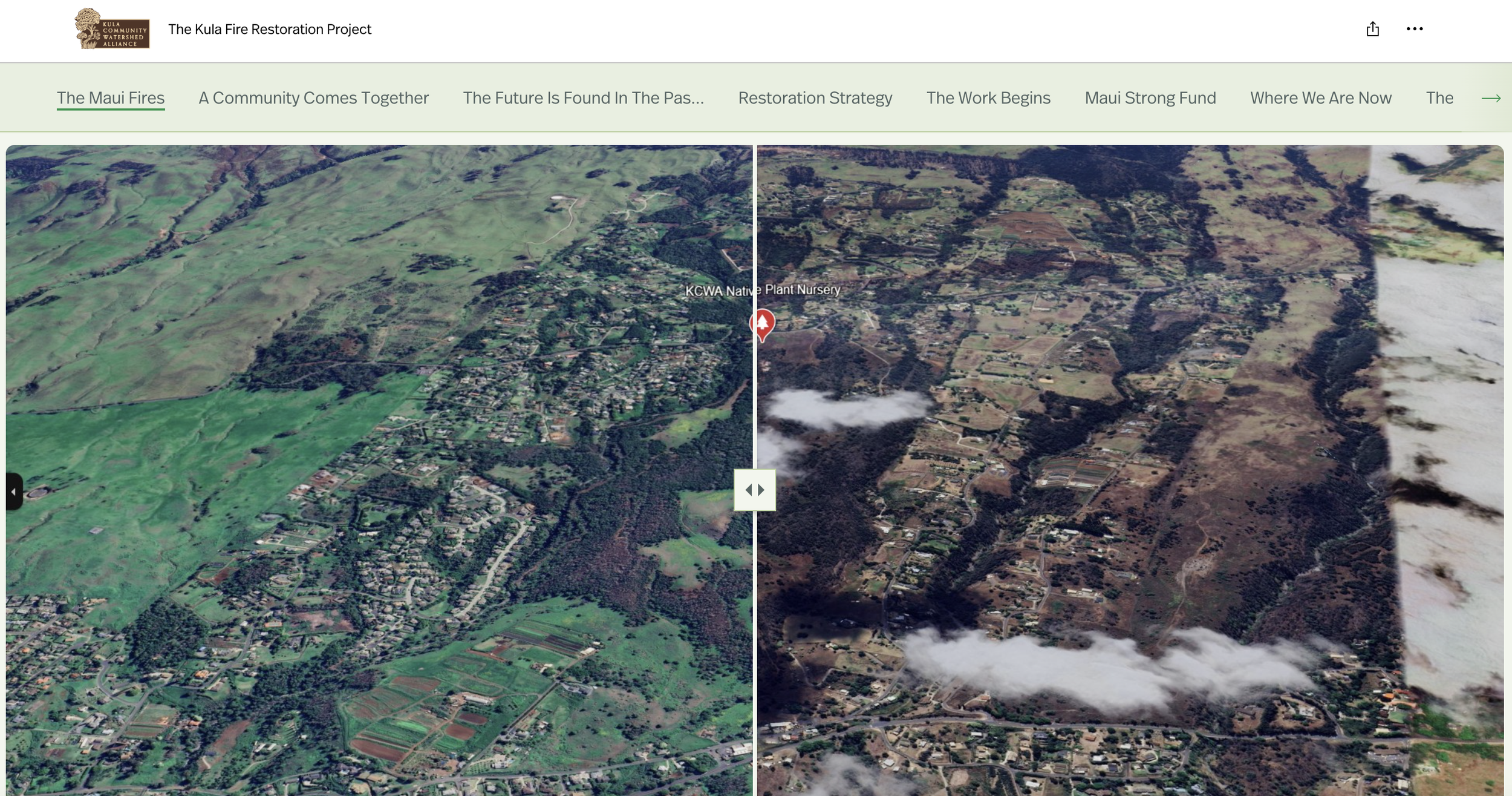
Explore the burn scar spatially through maps, treatment areas, restoration zones and project progress.
Monitoring & Learning
See what the land is telling us.
Follow the indicators we use to understand soil stability, vegetation recovery, invasive pressure, ungulate impacts and watershed function over time.
Coming Soon.